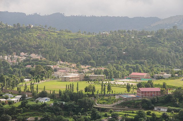
The Sudhnoti district of Azad Kashmir is bounded by Rawalakot district in the north, Kotli in the south and Pakistan in the west.Read More
Temperature in summer is almost 20 to 35 °c and in winter -5 to 25 °c. in winter, one may see snow on the nearby mountains.Sudhnati is one of the eight districts of Azad Jammu and Kashmir in Pakistan. It comes under the Kashmir section which is part of the greater dispute between India and Pakistan. Sudhnoti was carved out of Poonch district in 1995. The total area of the district is 569 square kilometers, with a population of 214,000 in 1998. The district is divided into three tehsils these are:Pallandri, Mang, Trarkhel.
Azad Patan Bridge
Azad Pattan is a village in Sudhanoti District of Azad Jammu and Kashmir, Pakistan.
Sudhanoti District is divided into four tehsils, Pallandri, Balouch, Mang and Trarkhel.Read More
It is located on border of Punjab and Azad Kashmir on bank of Guoien stream (nala).
Guoien Nala/Stream is part of larger Jehlum River.
Azad Pattan is at a distance of 32km from Kahuta and 75km from Islamabad.
The Azad Pattan bridge on Guoien stream is connecting Islamabad to Rawalakot, Bagh and Pallandri.
Construction of the Ghazi-e-Millat road (also known as Guoien Nala road) between Rawalakot and Azad Pattan has considerably reduced travel time.
Muzaffarabad and Azad Pattan are among the wettest areas of the state of Azad Jammu and Kashmir.
The elevation of Azad Pattan is 495 m (1,625 ft).
GPS coordinates of Azad Pattan are 33.7320°N 73.6032°E.
The river roughly 7 km upstream of Azad Pattan
Bridge in the Sudhanoti
District, Azad Jammu and
Kashmir, Pakistan and 90 km from Islamabad, the capital city of Pakistan The project is scheduled for completion by 2026. In
July 2020, the project's $1.5 billion investment agreement was signed between
Chinese state-owned China Gezhouba
Group and Pakistan, in a ceremony attended by
Prime Minister Imran Khan and senior government ministers.
Pallandri
Pallandri, also spelled Palandri (Urdu: پلندری), originally Pulandari, is a Tehsil which serves as the administrative capital of Sudhanoti district of Azad Kashmir.Read More
Balouch or Baloch is a town in Sudhanoti District, Azad Kashmir.Read More
It is the highest most peak in Sudhnoti district parallel to but not in balanced surface proportion with the Bisarh’i peak.clarification needed The third peak is Baithak. It is located at 33°38’40N 73°49’25E with an altitude of 1769 metres (5804 feet).
Rani Balaspur Ki Bawli Palandri
The edifice is unpretentious.But the quality of construction is superior. So fine, in fact, that the building could only have been built for nobility.Read More
Nadia,my hostess in Palandri(Kashmir), said it was called baoli -the traditional subcontinental well with steps descending to water level.I imagined a structure like the Mughals were so fond of building.As I was driven a few kilometres outside Palandri town, Nadia told me the building is believed to have been a watering place for the animals of passing caravans and nothing more. When we arrived, the fine architecture immediately told me that the structure was much more than what they believed it to be. Ell-shaped with the rooms fronting an open courtyard formed by a low wall on two sides, the building comprises six rooms of various sizes.
Baral Fort
Fort Baral is located in the hills 12 miles south of Pallandri, the capital of the former tribal state of Jammu and Kashmir.Read More
Built in 1610, the fort is located at Kohala in the east, Atkura in the west, Pallandri in the north and Sahansa in the south. The foundation stone was laid by Sardar Saeed Khan Saduzai, Nawab of Sadhnauti in 1610, during his visit to the government. After the Third Sikh Saduzai War, Fort Baral fell to the Sikhs and Dogris Khan Saduzai History of Kashmir According to Professor Malik Iftikhar, from 1819 to 1832, one of the fifteen forts of the state of Sadhnauti which defeated the Sikh Khalsa was the fort of Baral, whose fortified chief was Mehdi Khan Saduzai.
Mong consists of 7 villages and 3 union councils: Mong, Patan Sher Khan, and Dhingroon Kanchri. the major villages in Mong are Mehna Naar’orri, Dhara & Daar, Thaneliyaan khoor, Kanchri, Dhingroon and Pattan Sher Khan.Mong is well connected by roads to major cities of Kashmir and Pakistan. Mong is connected to Pallandri, Rawalakot, Thorar. Daily buses carry passengers inter-state as well as within the city. The nearest major airport is located at Rawalakot.
Yadgar e Shuhda(Sabz Ali Khan Malli Khan)
Sabz Ali Khan and Malli were two Sudhan leaders, who were flayed alive at Mong 1837 by Jammu and Kashmir ruler Gulab Singh’s regime.Read More
Two of the close accomplices of Shams Khan, who were brought under a tree and both of them were hanged up side down and falyed alive in Mong. The practice of killing rebels continued for some time, other Sudhans leaders, Asghar Ali Khan of Chota Galla, Baz Khan of Hari, Baland Khan of Hari, Mir Baz Khan of Banjosa, Kaloo Khan of Namota, Fateh Sher Khan also of Namnota, Mahndi Khan of Dhamni, Muzammil Khan of Pallangi, Sarandaz Khan of Pallangi, Hayat Khan of Jandali, Jam Dad Khan of Rehara, Khaswa Khan of Khai Gala and Amir Ali Khan of Ali Sojal, Jammu Khan of Mong, Mastana Khan of Mong and many more were punished to deat
A hill top from which you can enjoy the entire surrounding area with ease in 360 panoramic view. A broad perspective in all directions, which very few hill tops have to offer. The road from Thorar to Jassa Peer isn’t smooth so jeep ride is recommended. Pines & old olive trees are there to greet you with their beauty. Jassa Peer also carries a significant place in history. As we approached the top we saw a marked grave there, which was of the head of Sudhan Tribe, Nawab Jassi Khan. The story of Nawab Jassi Khan adored the hill top in it’s own way.
It is the headquarters of Tehsil Tarar Khal. It is located129 kilometers (80 mi) from Islamabad,31 kilometers (19 mi) from Rawalakot and 32 kilometres (19.88 mi) from Pallandri at an altitude of 6,502 feet (1,982 m). Here, 10 km below Tarakhil and 32 km above Palindri at Chonchal Hill First Government of Sidhnoti Azad Kashmir on October 4,1947 was established.
Garatapar Waterfall Trarkhal
There are two routes from Islamabad to Gharatapar Waterfall Trar khel.Read More
The first road from RawalaKot to Trar khel and then to waterfall is one hundred and fifty kilometers long. The second route leads from Pallandri to the waterfall, which is 132 km long This waterfall is located between Trar khel and Hajira. It is 15 minutes away from Bazaar and 25 minutes away from Hajira. Tarar Khal is a town and tourist attraction in Sudhanoti District of Pakistan-administered Kashmir, which is disputed with India. It is the headquarters of Tehsil Tarar Khal. It is located 129 kilometers from Islamabad, 31 kilometers from Rawalakot and 26 kilometers from Pallandri at an altitude of 6,502 feet.